« August 2010 | Main | October 2010 »

September 2010 Archives

September 1, 2010

Forest Point & Pine Grove Trails (Cuyahoga Challenge)

The HikersThe weather was perfect today for our first hike in the Cuyahoga Challenge. I'm not sure why we always wait so long to start but we do.

millipedeWe saw lots of different trees (tulip, oak, maple, sassafras, pine, cherry, shagbark hickory and others), several millipedes, a toad or two, a deer, some yellow/brown slugs and a pretty grey speckled one, various fungi and some bird feathers.

toadwindow into decayWe heard chickadees, woodpeckers, flickers and chipmunks.

And only saw one other person on the trail.

And it was a good hike.


The Forest Point & Pine Grove Trails (approximately 2.3 miles) can be found near the Octagon Shelter in the Virginia Kendall Unit (pdf) of the Cuyahoga Valley National Park.

September 3, 2010

My Brain on Boatbuilding

I just might have to get the t-shirt from Chesapeake Light Craft.

BrainTeeBackSM.jpg

September 2, 2010

Brandywine Gorge Trail (Cuyahoga Challenge)

The HikersThe weather was again perfect today for another hike (second of ten) in the Cuyahoga Challenge.

This hike was at Brandywine Gorge.

The story goes that the waterfall here was supposed to be overrun by the nearby Interstate 271 but was preserved by a future-thinking highway administrator who broke some rules.

I'm not sure what the real story is but it's a very pretty creek, gorge and hiking area. I'm glad it was preserved, both from a history perspective (there were several mills using the water's power) as well as from a topography and nature perspective.

Quiet waters Garter Snake We saw quiet waters.

We saw a garter snake. (You can see its tail disappearing into the grass.)

We bumped into a brand-new Cuyahoga Valley Interpretive Park Ranger who was out on a hike to see what trails he would need to "interpret" in his new job.

We probably extended our hike by another ten minutes talking to this enthusiastic Ranger. Of course, it helped that he's a fellow Scouter.

Black Rat SnakeBut right before that, we saw a snake.

A huge, black rat snake that was quickly climbing a thin tall tree to get to a huge maple. By the time we lost track, it was easily 30-40 feet above the ground.

It was amazing.

We watched it over a ten-minute period and it simply slithered up the tree, reached out to another tree's branch and just kept on going.

And to think, if we hadn't stopped to allow the youngest a break while she ate her trail snack, we would have walked right past it!

It was a great day for a hike.


The Brandywine Gorge Trail (approximately 1.5 miles) can be found at the Brandywine Trailhead (pdf) in the Cuyahoga Valley National Park.

Blue Hen Falls (Cuyahoga Challenge)

The HikersThe weather was again perfect today for another hike (third of ten) in the Cuyahoga Challenge.

This hike was at Blue Hen Falls and included a short portion of the Buckeye Trail.

The Buckeye Trail forms a loop around the great state of Ohio with a couple of spurs that allow a hiker to start on the shore of Lake Erie and end on the banks of the Ohio River.

Over the years we've hiked a total of 10 miles or so, some of it contiguous.

I was surprised, though, just how short this particular hike was.

Impatiens capensisYellow JewelweedThe trail leads down from the parking area on an old asphalt road. There's a short leg and a nice bridge and then you find yourself at the falls!

We found two varieties of Jewelweed, an orange (Impatiens capensis) and a yellow (Impatiens pallida).

chipmunkBlue Hen FallsEven the chipmunks and chickadees were out.

And of course, there were plenty of blue blazes!

While there was one other car at the trailhead, we didn't see any signs that anyone else was on this segment of trail.

More hikersIt was a great day for a hike.


The Blue Hen Falls trail (approximately 0.5 miles) (pdf) starts at the Blue Hen Falls parking lot which is located on Boston Mills Road, west of Riverview Road (pdf) in the Cuyahoga Valley National Park.

September 4, 2010

Lake Trail (Cuyahoga Challenge)

The HikersThe weather started out very questionable but ended up being a fantastic day for yet another hike (fourth of ten) in the Cuyahoga Challenge.

This hike was on the Lake Trail (pdf) in the Virginia Kendall Unit (pdf) of the southern part of the Cuyahoga Valley (pdf). We've hiked the Salt Run Trail (to the west) as well as all the trails in the Ledges Area and Octagon Area but not this one, so we were curious to see if the geography would be different.

It didn't start out this way, but today was a great day for a hike.

I'm finding that one of the ways to enjoy these hikes (and not view each one as a "checkbox" on the way to earning the Cuyahoga Challenge) is to keep my eyes open for plants, animals, insects or other interesting things along the way. It's not just about bagging the hike!

FlowersMonarch CaterpillarAround the dam, we saw lots of milkweed and so got started looking for monarchs.

And there they were! We saw monarch caterpillars and eventually a monarch chrysalis and then another!

One of the nice things about doing these hikes is that we end up doing them together, as a family.

Monarch ChrysalisSphingidaeWe're planning on splitting up when the adventurers take on the Boston to Pine Lane (8 miles) while the others tackle Langes Run (3.5++ miles) or the Plateau Trail (4.9 miles).

It's been great and we since we're planning on completing the Challenge, we have a few more to go!

More HikersOn our way through the cattail marsh, we happened upon this moth, one of the Sphingidae.

It's just amazing to have this resource almost in our back yard!


The Lake Trail (approximately 1 mile) (pdf) starts at the Kendall Lake Shelter. It is considered an easy trail.

Oak Hill Trail (Cuyahoga Challenge)

The HikersThe weather started out very questionable but today ended up being a fantastic day for yet another hike (fifth of ten) in the Cuyahoga Challenge.

This hike was the Oak Hill Trail (pdf) in the southern part of the Cuyahoga Valley (pdf).

For some strange reason, I have no pictures of this hike other than the trailhead photo.

This area is old farmland that was allowed to grow over. There are shagbark hickory, beech, black cherry, tulip, sassafras and oaks as well as conifers.

We found a few mayapples and some wildflowers growing.

It's a nice, short hike.


The Oak Hill Trail (approximately 1.8 miles) (pdf) starts at the Oak Hill Trailhead. It is considered an easy trail.

Forest Point Trail (Cuyahoga Challenge)

The HikersThe 2010 Cuyahoga Challenge has this hike listed twice: once together with the Pine Grove Trail (for 2.3 miles) and again by itself (0.5 miles).

We decided to slip this one in on the way home today. The weather was improving (still very windy) but it was now mostly sunny and warm.

This trail changes just about every time we hike it.

The first time around this loop this season, it had been dry and all these little gopher mounds of dry dirt were everywhere. (We never did see what created them, so we're only guessing that this was gopher. Or chipmunk, perhaps.)

This time it had rained, so these were starting to wash away.

This time we found a little girl peering out from this oddly-shaped tree trunk.

She wasn't there before!

Not here beforeThe older hikers let the younger ones run on ahead. While we were lagging behind, we heard two loud "crack" noises from a ways off the trail. It was incredibly windy and we weren't sure if a tree was coming down or if it was coming down on or near us. Or even if it was coming down today.

Well, pretty soon my wife was able to point it out.

Tree FallingAnd with a great creaking, it fell another 20 degrees, just while we were watching it!

We saw no one else on the trail.

And it was a good hike.


The Forest Point Trail (approximately 0.5 miles) can be found near the Octagon Shelter in the Virginia Kendall Unit (pdf) of the Cuyahoga Valley National Park.

September 6, 2010

Geauga County Bicentennial Barn

The Geauga County Bicentennial Barn is in the middle of rolling, fertile northeast Ohio farmland.Geauga County Bicentennial Barn

We had taken in the Great Geauga County Fair and thought we'd take a detour home to see this Bicentennial Barn.

The barn is on the west side of the road (Madison Road) and faces east, so an afternoon photo shoot was not ideal (hint: go in the morning).

There's a fairly wide gravel driveway leading up to the barn and it is there that I decided to park.

These barns are huge and are required to be visible from roads and such. But they're not really public property. But you can't expect to have something this interesting on your land without some sight-seers, either!

As I was walking up, a pickup truck arrived at the farmhouse and so I waved. Two small boys tumbled out and tore over to see me. I asked if it was OK to take pictures of their barn and they were quite happy about that. I recognized their shirts as some 4-H shirts that we'd been seeing at the fair and I asked if they'd been there. Mom then suggested that they ask if I was interested in taking a picture of their frog (they'd been frog-racing at the fair).

I'm not sure what was up next because when looked up, they were all gone.

There are 88 counties in Ohio, so we've got a ways to go.

September 9, 2010

A little further down the trail

A little further down the path

Just a little further down the trail


My youngest son is frequently just a little further down the path than the rest of us. At 7.5, he's a real trooper and loves to hike.

Taken September 4, 2010 on Kendall Park's Lake Trail.

September 8, 2010

Wetmore Bridle Trail (Cuyahoga Challenge)

The HikersWe experienced downright fall weather during our next hike (seventh of ten) in the Cuyahoga Challenge. We started just after a noon picnic at the trailhead with bright skies, a few clouds, lot of wind and cool temperatures (upper sixties F).

This hike was on the Wetmore Trail (pdf) in the southern part of the Cuyahoga Valley (pdf).

It's one of the longer ones we've planned and we allocated most of the afternoon to this hike. The NPS rates this one moderate (some places rate it difficult) and certainly it's harder than some we've hiked but it felt a little harder than moderate. There were a fair number of ups and down and the fact that we were sharing the trail with horses didn't make it any easier. Even though we didn't see any while we were hiking, the trail feels much more groomed and designed for horses and their impact on the terrain was undeniable.

Goldenrod Bugs on MilkweedThis hike also showed us some marvelous fields and meadows. One was completely covered in goldenrod. (I'm resisting the urge to sneeze even now!)

Another was covered in tall, yellow flowers that looked similar to balsam groundsel (pictures).

Monarch ButterflyAnd of course there was milkweed here and there. On the Lake Trail at Kendall Lakes we saw a monarch caterpillar and a chrysalis.

This time we caught a glimpse of a monarch butterfly. Since we aim to follow leave no trace guidelines, I didn't leave the path to get a closer look. This zoomed image will have to suffice!

We also saw a number of chipmunks, running along and behind the large number of downed trees here.

At one point, my wife saw some tails running off into the distance. Deer or something else?

At one point we had several "somethings" calling to one another from different points around us. My wife took a recording and we hope to figure out was was making these sounds. (Perhaps woodcocks?)

Hooded WarblerOne of the highlights of the trek was seeing a new bird (new for us).

This hooded warbler was deep in a thicket, behaving just as hooded warblers are reported to behave.

At the time, we had no idea what it was, but this zoomed and cropped image seems to point pretty conclusively to it being a hooded warbler.

What fun!

So far, we've hiked 11.8 miles (Wetmore is considered 4.5, not 4.0) over eight days. Today was a challenging one and yet the three year-old kept up with us.

It was a great day for a hike.


The Wetmore Bridle trail (approximately 4.5 miles) (pdf) starts at the Wetmore Trailhead parking lot which is located on Wetmore Road, east of Akron/Peninsula Road Road (pdf) in the Cuyahoga Valley National Park. It is considered a moderate to difficult trail.

September 12, 2010

Tree Farm Trail (Cuyahoga Challenge)

The Hikers (Tree Farm Trail)I've been pleasantly amazed at the excellent hiking weather we've experienced on this Cuyahoga Challenge.

This was our eighth (of ten) hike in the Cuyahoga Challenge, so we're nearing the finish line with nearly three weeks left to go!

We started just after a one o'clock picnic at the trailhead with bright skies, a few clouds, lot of wind and cool temperatures (upper sixties F).

The Cleveland area seems to have a reputation for bad weather. I think folks tend to forget these late summer and early fall days when the temperature is warm enough to get outdoors but not cool enough for specialized gear. The skies are partly cloudy and yet lots of sunshine gets through to set off the millions of shades of green that are quite firmly attached to all the branches.

This hike held a couple of firsts for us.

Shrew or MoleRed-eared SliderOur first mammal, a (very dead) shrew (OK, the deer and squirrels are mammals, too) and our first turtle, a red-eared slider.

OK, maybe it was a mole. The kids thought it was a mole.

The water in the pond was quite foul-smelling and covered in green weed, probably duck weed. We didn't get close enough to find out, but after snapping the photo of the turtle, we ran on along the path to see what else was out.

We also saw our first black rat snake on the ground and close up. Our previous experience with this reptile was watching one climb a very tall tree at Brandywine Gorge.

Black Rat Snake

We also found some apples and pears growing wildly but didn't find any in shape to eat. Not sure if it's too early or too late in the season.

Searching for somethingThe face in the treeAnd we found an Ent. Probably. At least the tree looked like it had a face.

However, we didn't see it walking around. The pines around this tree were all in nice rows (remember, this was a tree farm at one time), so if this was an Ent, it had been doing a good job of shepherding these trees before we arrived.

It was another great day for a hike. The weather was nice, the route was well-chosen, the hikers performed admirably and the scenery was inviting. The company was particularly enjoyable as well!


A little further down the pathThe Tree Farm Trail (approximately 2.75 miles) (pdf) starts at the Tree Farm Trailhead which is off Major Road (Google Map) between Riverview Road to the east and Stine Road to the west (pdf) in the Cuyahoga Valley National Park. It is considered a moderate trail.

September 13, 2010

A Night at the Captains

Skipper and our little oneWe bought a block of tickets to the Lake County Captains this summer.

I cannot begin to recount all the fun times we had. And I hate to say it, but it was rarely about the baseball. It was nice that the Captains were having a winning season, but for the most part, the baseball is secondary.

As a friend of mine likes to cynically remind me, these folks are about publicity, promotion and razzmatazz. If a little bit of baseball interrupts their carnival, they don't seem to mind.

Fireworks 1Running the OutfieldWe enjoyed watching the kids run the outfield during the 7th inning stretch. We enjoyed the fireworks, seeing our names and birthdays up in lights on the big board, the games for flipping Kraft Singles, chasing fish around the infield, tossing tennis balls into hula hoops, and dozens of other gimmicks to keep the crown amused. We had fun interacting with Grover and Skipper and Skippy and standing around to get baseballs, cards and programs autographed.

Ben Carlson's practice batIn many ways it's quite different from a Major League game. Which major-league player would have given my daughter a cracked practice bat? (Well, future Major-Leaguer Ben Carlson did, that's who!) I doubt we'd ever have had that chance at a Major League game.

And it was fun to get ramped up with all the electronics, including the scoreboard hullabaloo and all the musical tricks they use to generate excitement.

And boy, was it ever loud!

Except when it wasn't and then the organ or the pre-recorded snippets of sound would wind up and eventually, they'd be telling us "everybody clap their hands!"

20100820 - LCC Scorecard.jpgHalf-birthdayAs my cynical friend likes to say, "in the old days" we used to know when to applaud the players with out being told to "make some noise"!

And it was that same friend that inspired me to return to keeping score, something I hadn't done in years. I probably enjoyed that game best of all.

I'm still not very good at it but I know for certain I'll be trying to score future games again.

So what was so much fun? A little baseball, a lot of fireworks, a bit of noise and a whole bunch of family.

We shivered through an early April game when it threatened to snow. We sweltered under the sun in August. We camped on the outfield after a great game. We dodged foul balls, ate hot dogs, gyros, hamburgers and ice cream. We brought our rain gear in protest of the darkening clouds.

We had a great summer.

Sailing Sandusky Bay

Cedar Point from the waterSaturday was the CABBS event at the Sandusky Sailing Club.

The weather reports were calling for cool, cloudy and rain starting around 2pm and thunderstorms later on. Not necessarily a great day to be out on the water.

My helmsman BIG and I launched around 1245 (without getting wet!) and were out on the water by 1300.

The wind was blowing 12 knots from the SSE so we plotted our course to stay within a range (distance and heading) to return easily when the weather got dirty. That meant cruising a north-south line from the Sandusky Sailing Club to Cedar Point. And back. And forth. And back. And forth again.

Sandusky to Cedar PointIt's about 1.5 miles from the SSC to the marina at Cedar Point, so we probably got 5 or more miles of water past our keel over the day.

During one of those times back to the SSC, we spotted a buoy near the entrance to their harbor (AKA "Sadler Sailing Basin").

Not wanting to miss anything, we sailed closer and there upon it, in teeny-tiny lettering, it pronounced that we were floating over a "ROCK".

Well, that's one way to advertise it.

BIG takes a breakAt 1400, (since we'd been monitoring the weather reports by radio) we decided we'd used up just about all the good weather available, turned around, waved good-bye to Cedar Point and headed south again.

At 1410, the first rain squall hit us and we put on our foul-weather gear.

At the same time, the wind died. Out came the canoe paddle. BIG helmed and learned to steer small, countering the force of my paddling and adjusting for the bit of wind we did get on occasion.

At 1420, the chase boat arrived and offered a tow. We'd decided that since we had another 40 minutes before things got dirty, we'd continue to paddle and sail and see what would come. I checked in with the land crew on channel 72, let them know we were headed in and continued to paddle.

Krazy Kat at restThe wind picked up a bit, I quit paddling and we were at the dock by 1445. Since we the wind was weak and the rain was (apparently) over, we decided to leave Krazy Kat in the water until 1730 when we would pull out. In case the weather improved and we could go back out before then.

So we hung out at the marina/harbor, checking out our hosts' bigger boat and watching the kayaks paddle around. Then we hauled Krazy Kat out (Still managing to keep dry feet! A dry launch and retrieval, both in one day! A new record for us!!!) during one of the bigger rain showers and went in for dinner at 1800.


Krazy Kat is a Phil Bolger design, sometimes called a Tinycat or the Bobcat design. It's similar to a Beetle Cat. I built her from 2003 to 2007 out of marine grade plywood and mahogany porch flooring. And a whole bunch of stainless fasteners.

The cleats, blocks, mast, tiller, mooring cleat, rudder, heck everything is handmade. Well, I bought the anchor and all the sheets. Victorian Outfitters made the sail from a Sailrite kit.

She sails great and can be seen frequently (but not frequently enough) in her home waters of Lake Erie near the Intercity Yacht Club (East Entrance) and sometimes La Due Reservoir.

September 14, 2010

Patch Trading at the 2010 National Jamboree

Trading PatchesAt first, trading patches seemed too scary for him, maybe too foreign a concept. But after the first trade, he seemed to warm up to the idea and pretty soon, we found that he'd walk up to where they were trading, put down his bag, spread out his collection and start working out these deals.

Did I mention he collected the Iowa council strip with an image of the USS Riverside NCC-1818 on it?

Yes, this Cub likes to trade patches.

September 15, 2010

Langes Run Trail (Cuyahoga Challenge)

The HikersThe weather was again perfect today for another hike (ninth of ten) in the Cuyahoga Challenge.

This hike was on the Langes Trail (pdf) in the southern part of the Cuyahoga Valley (pdf), about 2 miles south of Peninsula.

The trail is a bridle and hiking trail although we also saw joggers and dog-walkers.

I'm becoming increasingly convinced (on a personal level) that well-used bridle trails make for less-fun hiking experiences. The horses that shared this trail before us were messy both in what they left behind and how their hooves tore into the trail and created these mudpits periodically.

There was also a high amount of trail-braiding (not following the path, but weaving in and around multiple trees on the trail) which encourages trail followers (of all kinds) to wander and choose the path that is "right" for them. It turns things into a Leave No Trace nightmare.

FungusCaterpillerOnce again, there was plenty to see. My littlest quickly found a number of tiny orange fungi, shaped in contact-lens forms.

She also found a black fuzzy caterpillar. (Some day she'll stop saying "callipidder" and it will be a very sad day.)

CoyoteBootsWe saw our first coyote (although not the wild kind) and there were numerous breaks to observe the trees, the plants, rock formations and listen to the birds.

I may never complain about Cleveland weather again. It was cool, but not cold; bright, but not hot; breezy but not tempestuous. In short, it was a perfect day for a hike, with feelings of fall right around the corner.

The trail makes a loop and connects with he Wetmore Trail a hike we'd completed earlier. That didn't stop our enjoyment, however.

Swallowtail ButterflySomeday I'd like to come back and hike the Dickerson Run Trail and Tabletop Trail. Perhaps when I don't have little ones and we'll bring our bushwhacking leggings. We saw entrances for both trails but it appears that since the horses are forbidden to enter, the humans don't either and it's quite grown over.

Overall, it's a great trail and yet another one in the Cuyahoga Challenge that we enjoyed.


This way homeThe Langes Run Trail (approximately 4.5 miles) (pdf) starts at the Wetmore Trailhead parking lot which is located on Wetmore Road, east of Akron/Peninsula Road Road (pdf) in the Cuyahoga Valley National Park. It is considered a moderate to difficult trail.

Please note that the map's mileage number may be incorrect (too short).

September 18, 2010

Buckeye & Valley Trails (Cuyahoga Challenge)

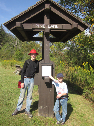
The HikersThe family split up this time to complete our tenth (and final) hikes of the Cuyahoga Challenge (pdf). This entry tells of the boys' trip, starting at Boston Store and heading south on the Buckeye Trail to Pine Lane, then west to Peninsula (still on the Buckeye Trail), then turning north on the Tow Path Trail back to Boston Store.

We've covered the Buckeye Trail segment of this hike to Pine Lane multiple times, with Boy Scouts and fully-laden backpacks, in the fall with little ones and at least once in the snow.

We've even hiked the Pine Lane to Peninsula once (in thigh-deep snow).

So what was left to do but hike the whole thing?

The Cuyahoga Challenge listed this as a loop at around 8.0 miles. Here are our official statistics:

7.26 miles
4.4 mph maximum
3.0 mph moving average
1.9 mph overall average
2 hours, 26 minutes moving time
1 hour, 23 minutes stopped

FungusWhat does this all mean? When we were moving, we moved. And we took a lot of look-around breaks.

We didn't move so fast that we didn't see cool stuff. Here's a tiny fungus growing on a log.

We over-packed and over-planned. We even over-communicated with the NPS folks at Boston Store. Seeing as we'd be out for four or five hours, we thought we'd leave them a nice note telling them who we are, where we were going, what we were carrying, our experience level, cell-phone number and when we'd be back. They seemed to appreciate this when we returned to the trailhead, but I couldn't help but wonder if this would only incite some worry.

Personally, I think this will be the last time I hike this section for a while. It was a busy, busy trail (runners, walkers and hikers) and the Tow Path was a virtual highway of bikes, runners, walkers and dogs. I think I need a road less traveled for my next one.

Boston Store south to TowPath Trail.jpgThe trail starts out flat, but quickly gets steep as it veers off to the east under Interstate 271 and away from the Tow Path Trail. This initial hill rises 242 vertical feet over the first 400 horizontal feet, somewhat unusual for this part of Ohio and it makes for a fun hike. This quick rise also gets the hiker off the Cuyahoga flood plain and into beeches, maples, oaks and sassafras.

Once over this ridge, the trail parallels Boston Mills Road, nearing the Ohio Turnpike (I80) at one point for a dramatic overlook, then nearing and then crossing Boston Mills Road.

The trail stays away from Boston Mills Road for a bit, wandering around a pine wood, then winding among some old home foundations before returning to the road and using it to cross I80 over to the south and another old pine tree farm.

The rows of old pine trees look majestic, almost cathedral and this is a good place to take a break. With the Valley Bridle Trail coming in from the west and crossing here, a loop can be made (on the VBT) back to Boston Store or the VBT can be used as a speed course directly to Pine Lane Trailhead (and Route 303). Choose the longer road through the rows of pine trees, keeping your feet aware of their "trippy" roots (my daughter's contribution to our lexicon).

At the southern end of these pine trees, another trail can be found that reportedly heads to the Hudson system of trails. Stay on the Blue Blazes and meander the ridges to the old Akron-Peninsula road (now abandoned). Also called North Locust, I suppose it's possible to follow this west into Peninsula and the train station.

The trail follows this road east a bit, then south into the Boston Run valley. From crossing the AP road to this valley, you'll hike three-quarters of a mile and drop a good 150 feet to this creek.

Strangely enough, it's another three-quarters of a mile to Pine Lane Trailhead and another 150 feet up to that point.
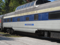
CVSRThe trail to Peninsula follows Pine Land Road, an old, steep brick lane that drops another 150 feet to the town level. Take the sidewalks on the north side of the street and keep your eye open for the Blue Blazes!

If the train is running, you may get stopped by the Cuyahoga Valley Scenic Railroad. If you're too tired, a few dollars might get you back to near Boston Store.

Otherwise, cross the tracks, head into the parking lot and stay to the south and west. You'll see signs for the Tow Path Trail and Boston Store (but no further Blue Blazes). Head north and stay to the right! This can be an extremely busy thoroughfare!

Canal ruinsMake sure you stop from time to time to understand what you're walking along, on and by.

The Cuyahoga is to your west (left) and the canal is to your right (east). You're on the tow path where the mules and horses would tow the canal boats north to Lake Erie or south to the Ohio. The sandstone walls of the locks all have stories, so stop to read the explanations from time to time.

Garter SnakeTurtlesThe path also passes through some fairly wild land: a couple saw a coyote the day we were passing through.

We got a closeup view of a garter snake and a long-range view of some turtles sunning themselves.

The Tow Path Trail is fairly flat, so enjoy your walk back to Boston Store.

Two more things: when you get back to Boston Store, make certain you stop at the museum and get a better understanding of what a canal boat looked like and how the canal system and the locks worked. You've seen them up-close now, so you'll have a greater appreciation for what's in the museum.

And stop at Trail Mix (north side of Boston Mills Road) for some ice cream.


The Boston Store to Pine Lane Trails starts at the Boston Store trailhead (pdf) in the Cuyahoga Valley National Park. It is considered a moderate to difficult trail. The Tow Path Trail back to Boston Store is considered easy.

Covered Bridge to Furnace Run and return (Cuyahoga Challenge)

The HikersThe family split up this time to complete our tenth (and final) hikes of the Cuyahoga Challenge (pdf). This entry tells of the girls' trip, starting at Everett Road Covered Bridge and then heading into the Summit County Metroparks and taking the Furnace Run trail.

As expected, the weather was excellent. This 2.3 mile trip takes hikers from the bridge into the woods where many different species can be found.

No horses or bicycles are allowed and if you attempt to ride on certain days, you might be reminded of that fact by certain hikers nearby.

There are some extremely steep parts and the rest is fairly gradual slopes.

It's not a long hike, but water and snacks are essential.

All of the Cuyahoga Challenge hikes are loops, including this one. A portion of the trail is done retracing one's steps.

WoodsHappy HikerDepending on the time of day, the season and how loud you are (or how small your children are), you may get to see various wildlife along the way. No doubt there will be some chipmunks who are unhappy to see you.

This marks the final hike of our Cuyahoga Challenge for 2010.


This trailhead can be accessed from the Everett Covered Bridge on Everett Road, west of Riverview Road in Peninsula. It is in the southern part of the Cuyahoga Valley National Park (pdf). This trail is considered a moderate trail.

September 20, 2010

Cuyahoga Challenge

Dear Cuyahoga Challenge Participant,

The HikersCongratulations on making it to your final destination! I hope this year you have been tested and pushed by all of the challenging trails! No matter your skill level; whether you have forged on through the mud, climbed steep hills, or braved bad weather you have rewarded yourself this summer by taking in views of this lovely valley! The trails in Cuyahoga Valley National Park are a signature source of solitude and they are one of the many things that make this park unique and beautiful.

Enclosed is the 2010 Cuyahoga Challenge patch, designed by local artist Chuck Ayers, commemorating the kick-off of TRAILS FOREVER with the Brandywine Gorge Trail Bridge. . . .


And so begins the letter that each one of us received at the end of our tenth Cuyahoga Challenge hike this past Saturday.

If you've been following along on our journey, you'll know that the letter is right and wrong.

Skill level

We had a wide variety of skill levels in our troupe. From a 3.9166 year-old girl to a 14 year-old Star Boy Scout and lots of variety in between, we finished the ten hikes. And no, we didn't carry the little girl.

Mud

Actually, we didn't find much/any mud. Just on some spots of the bridle trails. Otherwise, nope, no mud.

Steep hills

Yep! Lots of steep hills including a really nice 400 footer at the beginning of the Boston Store trip.

Bad weather

Huh?! Nope, no bad weather this September. Now, if we'd started in June, July or August, well, there were some nasty weeks of weather then.


We did it!

Much to my amazement when we picked up the patches at the Trail Mix store in Boston, I was able to quickly identify the bridge on the patch as being the footbridge over the Brandwine gorge on one of our hikes. Ironically, we followed the path from the south on the upstream side and forded on the rocks. The prettiest bridge in the whole park and we chose to wade.

Cuyahoga Challenge patch 2010

Here's to the Cuyahoga Challenge 2011!

Cleveland Sunrise

Landmark Office Towers

The Landmark Office Towers as seen from Prospect and East Fourth


Greater Cleveland Council Service Center

The Greater Cleveland Council's BSA Service Center as seen from their eastern parking lot

September 21, 2010

Fall is not waiting

Reflections of Fall

Maple trees against a blue sky, sporting their almost-Fall plumage
(reflected in my iPhone on a flannel shirt)

September 24, 2010

Durin's Day 2010

'Then what is Durin's Day?" asked Elrond.

'The first day of the dwarves' New Year,' said Thorin, 'is as all should know the first day of the last moon of Autumn on the threshold of Winter. We still call it Durin's Day when the last moon of Autumn and the sun are in the sky together. But this will not help us much, I fear, for it passes our skill in these days to guess when such a time will come again.'

It appears that Durin's Day in 2010 will be in early December, the threshold of Winter.

Winter itself starts on December 21st, 2010 at 1747 UTC, with the Full Moon occuring at 3:14 am EST (0814 UTC) that day.

The last moon of Autumn starts on this threshold (Sunday afternoon, December 5th at 12:36 pm EST or 1636 UTC).

Moon & Sun on 20101205 at 1644 ESTOn that day, the moon sets at 4:51 pm (2151 UTC) while sunset for my location (near N 41° 30' 36.4212" W 81° 34' 44.1588") is 4:56 pm (2156 UTC), five minutes later. In The Hobbit, we read that on Durin's Day, "the sun sank, the moon was gone", implying that sunset takes place first, so December 5th isn't Durin's Day.

Not only is the order of setting wrong, but the amount of moon showing is so slight (due to the short apparent angular distance between the moon's and the sun's centers) that it's doubtful it would be seen.

Moon & Sun on 20101206 1650 ESTOn December 6th, the sun sets at 4:56 pm (2156 UTC) and the moon sets at 5:50 pm (2250 UTC), nearly an hour later. At that point, it will be nearly 0.03% illuminated, just a thin crescent.

I think this day (December 6th) is the best candidate for Durin's Day in 2010.

The order of setting is correct and there's likely to be enough moon to see (between 0.016% and 0.03% visible).

The United States Naval Observatory indicates that the record for an early sighting of a lunar crescent is 15.5 hours from New Moon for a naked-eye sighting and December 6th falls outside that mark.

Moon crescent visible - 201006 2156UTCThe computed phase of the moon for a few hours later on the 6th is shown nearby.

The website crescentmoonwatch.org seems to agree with us. While they indicate (pdf and jpg) that it will be difficult unless the atmospheric conditions are correct, they do think that northeast Ohio should be within the visible range. The likelihood of seeing it on December 7th is even greater (pdf).

So there you have it. Durin's Day is the first day after the last New Moon before Winter, December 6th, 2010. Head out to the west at sunset and look for the tiny crescent.

Durin's Day for 2007, 2008 and 2009.

The moon/sun position images were taken from Stellarium.

About September 2010

This page contains all entries posted to CurlyShavings in September 2010. They are listed from oldest to newest.

August 2010 is the previous archive.

October 2010 is the next archive.

Many more can be found on the main index page or by looking through the archives.

Creative Commons License
This weblog is licensed under a Creative Commons License.