
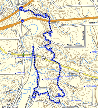
It's about 13 miles on the Buckeye Trail from Brecksville Station to Boston Store. And most of it is beautiful country. There are hills and valleys, ridges and meadows, trees and rocks, creeks and waterfalls, wildlife and silence.
While this part of the Cuyahoga Valley is never too far from civilization, it's still possible to be alone in the woods on much of this trail. I think I saw six people total over this stretch on the Thursday I hiked it last week.
Brecksville Station
Brecksville Station is a convenient spot to start this hike and it is there that I parked my car shortly before sunrise, headed over to the old wrought iron bridge (1882 and more) that spans the Cuyahoga and waited for my GPSr to settle down.
The fog was still fairly heavy and the trees were dripping but I soon got moving west, following the blue blazes, out of the station area and south into the meadow.
Brecksville Reservation
Once across Riverview Road, the trail heads into the hills and trees of Brecksville Reservation, one of the many Cleveland Metroparks that makes living in Cleveland such a pleasure, eventually joining up with the Salamander Loop Trail for a while (large pdf).
At this hour, there was no one else on the trail and it wasn't until I made a detour to see Deer Lick Cave that I saw another soul.
Near this spot is one of the corners of the Buckeye Trail, the northeast corner where the Medina, Bedford and Akron sections come together. Lake Erie is only 65 miles away to the north. Heading south (clockwise), the Ohio River (at Cincinnati) is 653 miles away or only 488 miles if one takes the western route (counterclockwise).
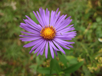
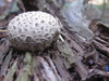
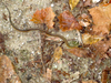
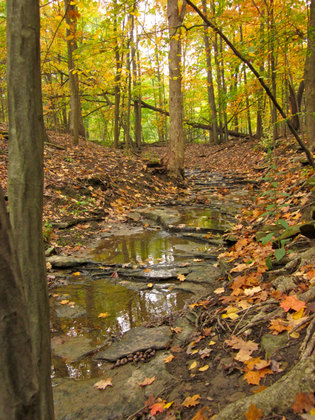 The leaves were beginning to change. Many factors play into this including the temperatures that trees are exposed to, so while some trees were still clothed in green, others were tinted with Fall, some were thinking pretty seriously about wholly changing and others had already given up every last leaf.
The footpath and surrounding scenery were a never-ending carpet of greens, yellows, browns, reds and purples.
The terrain varies quite a bit, sometimes going up steeply over rocks and roots while at other places the trail stays to ridges and meadows. It is very rarely straight!
This meandering opens up all sorts of views and perspectives on the surrounding features.
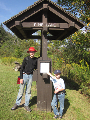
Taking the Akron Section from this corner and heading south, the trail joins up with a bridle trail on the south side of Valley Parkway and past the Brecksville Stables where it becomes a foot path again. Here the Buckeye Trail passes through Ottawa Point. Nominally a picnic area, it looked ideal for a group campsite and I may need to research getting permission for a Scout backpacker trip to pass through here.
While there are many streams, creeks and rivulets, none are serious enough to warrant a foot-wetting. Even the larger creeks can be dryly crossed if scouted out first and then taken with care and a hiking pole. I can imagine that after a Spring thaw or heavy downpour this might be a different story.
It was here that I saw my first hiker. He and his dog had started at Snowville Road, were hiking north on the BT and were hoping to catch the Valley Bridle Trail back to Snowville. Looks like about a 6-mile loop (pdf).
It was in this area that I had my first problem following the blazes. A metal post had been planted with two 3''x6'' metal "cards" on it, one right above the other. The blue blazes had been painted on these "cards", one right above the other. But it was clear that no trail led straight ahead; there was one leading to the left and one to the right. Nothing to do except follow each until finding the next blue blaze. (Of course I took the wrong path at first!)
These metal posts were rare (only three of them) but each showed straight ahead but should have indicated a right turn. Later on I figured out that anytime a metal or 4''x4'' post was used, the trail was close to an access road of some sort. All other times, the blazes were lightweight paint on existing trees!
Snowville Road to Columbia Road
At Snowville, I came across two joggers and a small, fluffy dog. This segment has some good ups and downs, so I thought it would be easy to leave them behind. "Slow and steady wins the race" sort of stuff. That was not to be, however. They'd jog and get ahead of me, then walk and I'd catch up. Then they'd jog again and pass me and repeat the cycle. I decided to stop, take a break and some pictures and let them get far, far ahead.
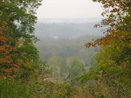
I found a good spot high on a ridge looking over the Cuyahoga Valley toward Brandywine Falls (pdf).
The valley is still wrapped in fog and the sun hasn't fully burned it away.
I was a little past the halfway point. So far the maps had been good, the solitude was welcome, the terrain had been challenging and the scenery unending.
I haven't yet come up with a good way of taking notes while on the trail but the back of my Brecksville Reservation map has some scribbling.
Where one mile blends in with the next only in the seamless wonder of the every-varying colors of leaves fading, tree trunks of shapes and angles and creeks wearing down stone.
It feels as if I was trying to capture the variety, almost a visual overload that I was experiencing. At one level, the seven miles had been a single scene of trees, leaves, plants, creeks and rocks. And yet at another level, every few seconds showed a unique arrangement of these trees, leaves, plants, creeks and rocks. Even as the dominant species of one area blended into another (beeches to maples, maples to oaks) or the scent of white pine gave way to wet sycamore, there was a never-ending array of variety.
And yet the vast variety could only be comprehended by its sameness: "that next tree is just like the thousand other maples I've seen so far today". Seeing the forest as a whole was the only way to grasp the tree-by-tree detail. I was having a great time.
Columbia Road to Blue Hen Falls
The joggers had reached Columbia Road before me and I met them headed back to Snowville Road (although without their fluffy dog).
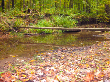
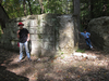
Columbia Run cuts a valley 150 feet deep into this section of the trail but it was a gentle, quiet stream when I crossed this morning. Just prior to reaching the Run, I encountered a couple headed south with backpacks so I smiled and passed them by.
I had left a hike plan with the Boston Store rangers prior to leaving this morning and they were only going to be there through 4pm. While in reality, I'd have plenty of time, there was a nagging in my mind that I'd get there after Boston Store closed and they'd call out a search party.
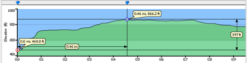
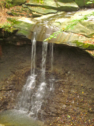 Out of the Columbia Run valley, the trail climbs steadily for about a mile to gain some 200 feet before sharply descending 100 feet to Blue Hen Falls (pdf) where I decided to have some lunch and see if the thermos of tea I'd packed was still warm.
By this point, my pack was getting lighter (half the water was gone, lunch was gone, trail snacks were 50% gone and the steaming tea was mostly gone). As Roger (of Swallows & Amazons) has observed, lunch travels so much better "inside us" than in a knapsack.
The couple caught up with me by this point and we talked briefly about the wonder and beauty of these trails. (They also noticed that the fluffy white dog didn't make the return trip with the joggers.) I wished them a good journey on their way back north and we said goodbye.
The trail south from Blue Hen Falls follows an abandoned roadway steeply up another 100 feet to Boston Mills Road. Here I lost the trail. I knew it crossed to the south but I couldn't see where so I walked along the road until it emerged from the woods. I wanted to hike the whole trail, so I followed it back to the missing blaze and doubled back to continue on.
Boston Mills Road to Boston Store
 It's been said that the BT keeps you in the woods but never far from civilization. This section is densely-forested in beech and maples. Once across the creek and up the steep stairway (90 feet, straight up), all traces of the outside world are gone again except the roar of Interstate 271.
And yet this was some of the most magical of the hike. Every fallen log harbored a chipmunk who would scold me as I walked past. By now, the sun had burned through the fog and haze to illuminate the glorious greens and golds, making the trail seem like something from Lothlórien.
I was having a great time but the end of my trail was near.
Arriving at Boston Store in plenty of time, I checked in with the National Park Rangers who seemed truly appreciative that I'd provided a hike plan.
Stanford Backcountry Campsites
Since I had so much extra time, I continued on up the Towpath Trail to where the Stanford campsites are. These are the only legitimate campsites in the Cuyahoga Valley National Park and I wanted to see them for myself for future reference. (I think it would make a good beginner's Scouting backpacker to start at Brecksville Station on a Friday afternoon, hike to Ottawa Point and camp for the night, then start up the next morning and continue on to Stanford (pdf and details) and the next morning to Peninsula or even Butler/Manatoc. I'll keep you posted.)
The campsites scouted, I returned to catch the train back to my car. On the way to the station, I found the hiking couple again, enjoying the rocking chairs on the Boston Store porch. They had returned north to their car and as the sun had broken through, decided to enjoy the rest of the day in the valley.
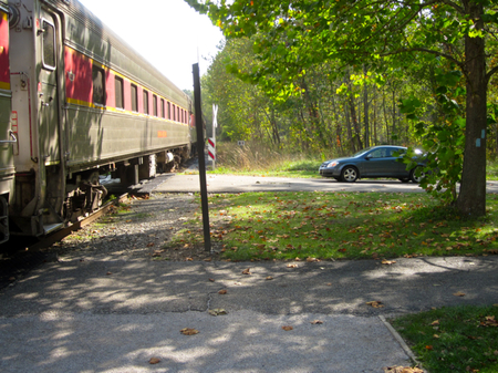
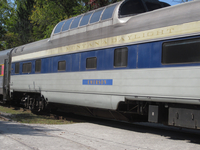
Cuyahoga Valley Scenic Railroad
The CVSR has frequent service up and down the Cuyahoga including their Bike Aboard! program. This allows bikers to go one way by bike and return by train for only two bucks. Unfortunately, this only applies to bikers and not hikers. If only I'd stashed a bike at Boston Store that morning, I could have walked it to the station and claimed a six-dollar discount!
I was soon back to my car and thinking about what my next segment of the BT would be. While I usually hike with my family, I think the four year-old would have troubles doing all thirteen miles. We'll probably break it into two segments (Station to Snowville, Snowville to Boston Store) and tackle this again next spring.


